Friday, July 12, 2013

Grisedale Pike via The Grind

the route we took up Grisedale Pike

I should know better.  I wasn't sure I was going to make a meet up with Jonathan and Gerard today for a fell run.  I was on top of Red Screes when I got a call from Jonathan who told me he was, "on his way".  Jonathan also said that Gerard's knee was still bothering him so we would only be doing an easy trail run today.  I should know better.

almost 9 miles with a killer climb

We met at Braithwaite and headed off up Whinlatter Pass, breaking off to head along a really nice trail.  After a bit we started climbing gently with a few long sustained climbs.  All very manageable.  The heat was making it hard but all in all we managed well.  We had a bit of a rest at the viewpoint and Gerard pointed out the climb up to Grisedale Pike.  Yikes!

nice easy trails through the forest


evolution of running shorts - left to right

The Grind
The Grisedale Grind is a fell race put on each year by Keswick Athletics Club.

The record for the race is approximately 27 minutes.  It goes from the visitors centre, through the woods and up the steep path you can see on the picture on the left and then back down again.

I'm not sure how long it took me to get up but I know it was a hot hard slog and it wasn't fast.

Gerard was in front as usual but even he wasn't able to run the whole way up.


almost at the top of Grisedale Pike

on the summit - it's definitely downhill from here

From the summit we headed over to Coledale Hause and then descended to the mine road for a few miles back to Braithwaite.  Jonathan and Gerard went for a dip in the beck, I went for a pint of Blackcurrant and Lemonade.

Gerard and Jonathan traversing above Force Crag Mine

Jonathan not taking the plunge like last time

ahhhhh!

Red Screes and Middle Dodd

from Red Screes trig column over to Froswick and Ill Bell

I was out nice and early this morning to bag a couple of Eastern Wainwrights.  The climb up to Red Screes is pretty straightforward from the car park.  There is a decent path all the way to the top.  From here you can see the lower Middle Dodd and it's a nice little stroll down to this summit.  I made my own way down the steep side of Middle Dodd rather than follow a path and then continued up the road over the top of the Kirkstone Pass back to my car.

just under 3 miles

misty car park

climbing now looking back over the car park and the pub

cloud soon burned off

Red Screes.  Brothers Water is visible to the right of the trig column
 
down to Middle Dodd
 
Middle Dodd

I set off to do these fells a few weeks ago and parked in the car park and then didn't bother going up because of cloud.  I'm glad I waited, some beautiful views today.

Thursday, July 11, 2013

The Conistathon

hydrating

cheers!

Athletic endeavours come in many shapes and sizes.  Jonathan and I dabbled in triathlon last year, entering sprint triathlons, all of which had the swim section in a pool.  The next step would be to enter triathlons with open water swims.  This had  been my plan for this summer but, over the winter months, I got more and more into fell and trail running and the biking and swimming, particularly open water swimming took a back seat.

A week off work and some scorching weather seemed the ideal opportunity to get back into things.  Proper triathlons can be quite expensive, sell out quickly and tend to have a longer open water swim than I am comfortable with. Therefore, I conceived the Conistathon, a swim, bike and a run in the Coniston area.  The goals were to get a swim and bike in and then bag Green Crag (a Wainwright Fell in the Coniston area) on the run section.

After some online research, I identified Monk Coniston car park as a great location to start the swim and bike from.  It's right on the shore of the north end of Coniston.

nice calm Coniston

Jonathan warms up

Paul breathes in

The swim was interesting.  The entry from the car park was nice and I got in and got swimming quickly.  I usually find that I take a while to get my confidence to head into deeper water.  The water was lovely and warm and we just headed out.  We swam through a large reed patch which was a bit disconcerting but after a bit, the water got deeper and so we were clear of the reeds.

So confidence was fine (open water swimming is all about confidence) but I just couldn't get into the swing of the swim and was struggling with breathing properly.  We hung around for a bit in the middle of the lake and then headed back to the shore.

A few flapjacks later and a lot of mucking about trying to untie my car key from my wetsuit, we headed off on the bike leg.

all ready to go

We headed right from the carpark and along the eastern shore of Coniston.  This is a nice road to cycle and we went past lots of other good swim locations.  We might have to explore some Swallows and Amazons islands, swims and other territory at some point.  We looped out from the lake at the south end, taking in a big descent at Grizebeck before heading up to Broughton in Furness where we stopped for refuelling.

food and hydration
As we should have expected, beer and crisps are not great fuel for a bike ride.  For the next mile or so we plodded along but soon after, we got back into the swing of things.  The road from Broughton in Furness to Coniston is quite a good one.

We did a few extra loops of the car park to take the distance up to 26.2 miles so that Jonathan had an idea of a marathon distance.  Then it was another transition, sorting the bikes out, getting changed, and driving off to the run start, tucking into more flapjacks on the way.


There are plenty of run options that we could have taken from the car park.  Coniston Old Man would have been a really good route to do.  However, I had another motive of bagging a far flung Wainwright so I had made a run course starting from the Newfield Inn at Seathwaite.

The first part of the course was the same route I took on my recent Duddon Horseshoe run.  This is a really nice start through the woods and then on to Grassguards.

From here, the path goes through the forest and it's not great.  There were a lot of flies around.  Jonathan tried and tried the technique of swearing at them but it didn't work so the only option we had was to keep going.

We both had tired legs at this point and we walked most of the way to the edge of the forest.  From here we took a track across to Green Crag.  

Again besieged by flies, we made steady progress to the summit.

On the summit, we met an interesting fellow who told us about marshalling at the recent Saunders Lakeland Mountain Marathon (or SLiM as he called it).  We also heard about his hiking exploits over the last week (which seemed to include a lot of sunbathing).  He took a picture for us at the summit and then headed off towards Eskdale.

I had originally though about heading to the Birker Fell Road and then running along here back to Seathwaite but we decided against this for a more direct route.  We took a compass bearing to the top of Caw and headed back in that direction.  After a bit of fence hopping and heather negotiating, we got back on a track through the woods and back to Seathwate for some food and further refreshment.

top of Green Crag (Wainwright number 210 for me)


run route

back at the Newfield Inn


Tuesday, July 9, 2013

Middle Fell, Seatallan and Buckbarrow

great view of the Scafells from Middle Fell

A mid day set off to bag three Wainwrights in Wasdale.  Today was very hot.  Sunscreen, 2 litres of water and a very funny looking (but very functional) hat made the heat quite manageable.  There were a lot of flies about on Middle Fell but not really anywhere else.


5.5 miles from Greendale

it must be hot to swim in Wast Water
Greendale is the small hamlet you pass through on the way to Wasdale Head.  It's where the legendary fell runner Joss Naylor lives.

One of those things that you don't notice until someone points it out, and then you notice all the time, is how well kept the stone walls are around Greendale.  Perhaps a retired sheep farmer with a lot of spare energy spends some of his time maintaining these walls?

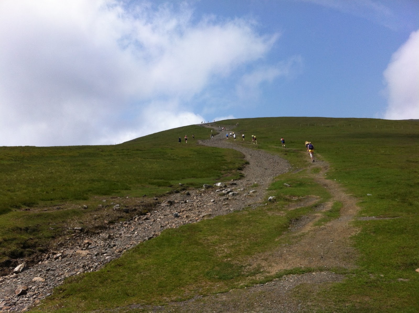
Greendale is where my walk started from today.  There is a small parking area just past the houses with room for about five cars.  The path up to Greendale Tarn is clear through the heather and is easy to follow.  As the path curves around the fell, another path leads off over the summit of Middle Fell.  Today, the walk up that path was very hard work, sweaty and slow but I imagine most of the year, it's a fairly easy stroll.


Greendale and those walls (my car is parked to the left of the houses).

Middle Fell is in a great situation.  The views over the Scafells today were breathtaking.  The shadows of clouds made the cloud look really low.  All the Wasdale big hitters were visible today but it was the view to the Scafells which took centre stage.  There were lots of flies on Middle Fell, meaning that I didn't stick around too long.  The climb to Middle Fell was the hardest part of the day and, once I was up here, it was very easy going for the rest of the walk.


Scafells from Middle Fell

Wasdale Screes

From the top of Middle Fell, there is a nice path down to a bit of a boggy section between Middle Fell and Seatallan.  The climb up Seatallan looks quite daunting but it is not difficult and is soon over.

looking back to Middle Fell with Greendale Tarn on the right.  The path I took is visible to the left

The top of Seatallan is flat and green, surely prime candidate for a wildcamp?  From the top you can see over to the sea and, in the other direction, the Scafells peek over the top.


over to the sea.  Sellafield is just visible

Scafells peeking over

grassy descent
From Seatallan, there is a really nice grassy path that goes down towards an area marked as Cat Bields.  I followed this for quite a way and then headed off directly to Buckbarrow.  This track would be great to run on and has been noted for the future.

As you approach Buckbarrow, there is a cairn to the right.  This is not the summit, the actual summit is further on, on a separate mound.

Once I had located the summit, I followed paths which took me towards Greendale Gill.  I could have followed a path around the crag which would have taken me further up the road but I decided to descend down another Gill, cross the main Gill and then climb up to the path I had started on which I could see.  From here it was an easy and pleasant descent back to the car.

over to Buckbarrow

once again, the Scafells - Middle Fell in the foreground
 
from Buckbarrow looking back towards the Scafells with the head of Wast Water visible

Sunday, July 7, 2013

Skiddaw Fell Race 2013

pretending to run on the hardest part of Jenkin Hill


Skiddaw Fell Race is a classic race.  The race briefing was pretty much, "you run up Skiddaw, you turn around, and then you run down."  Much easier said than done.  Skiddaw is the fourth highest fell in the Lake District and the up and down on this race is the unforgiving, relentless path that can be seen from a distance winding its way up.

Thanks to Cumbria Running Photos who took some of the glamorous pictures here.

9.5 miles - roughly 3000ft of elevation

Jonathan and I have been doing some hill runs and are pleased with ourselves that we can get up to the car park by Latrigg without stopping running.  Our usual time for this is about 15 minutes.  Today it was a bit slower, it was a very very hot day and I was allowing a runner in front to lead me up the path at a reasonable pace.  I was also aware of the steeper climb to come up to Jenkin Hill and then up to Skiddaw itself.


steep

I ran to the gate after the car park and then, like most people it seemed, I started walking.  We've had a go at running up Skiddaw before.  We managed to run some decent sections of it but that was with a few recovery stops.  Today, I didn't stop but I walked most of the way to Jenkin Hill.
Just before you reach a gate, the path levels off and I started running again there.  A few minutes later, the first runners passed me on their way back down.  There is another gate and then the next climb up to the summit ridge.  Skiddaw is rocky along the top and there is a slight downhill and back up before circling the summit shelter and heading back down.

first runners heading back down

Just as I started back down, I managed to kick a football size rock, "ouch!"  I'm quite good at descending and I managed to overtake quite a few people on the top part of the path.  It's probably a good idea to do this as lower down it gets much steeper, which meant for me that I had to slow down and zig-zag a bit.


on the way down, feet are screaming


If I had any toe-nails, they would have been hurting before the end of the track.  I can usually open up and leg it from the car park but today my legs and feet were trashed and so I took it pretty easy.  Turning back onto the finishing straight, I was really out of energy but I kept going and crossed the line in 1:50:24 for 82nd place.

I found a spot in the shade, sat down and finished the rest of my drink.  Jonathan was next across the line about 30 seconds later.  He sat down and took his shoes off and had some nasty looking blisters.

After rehydrating we headed to the Lakeland Pedlar for drinks and cake.  Very proud of ourselves for doing this.  We didn't get fast times but it's a proper grown up fell race.


Jonathan hydrating

and again, much more civilised, even got his pinky out

my turn

told you it was hot

ahhhh!